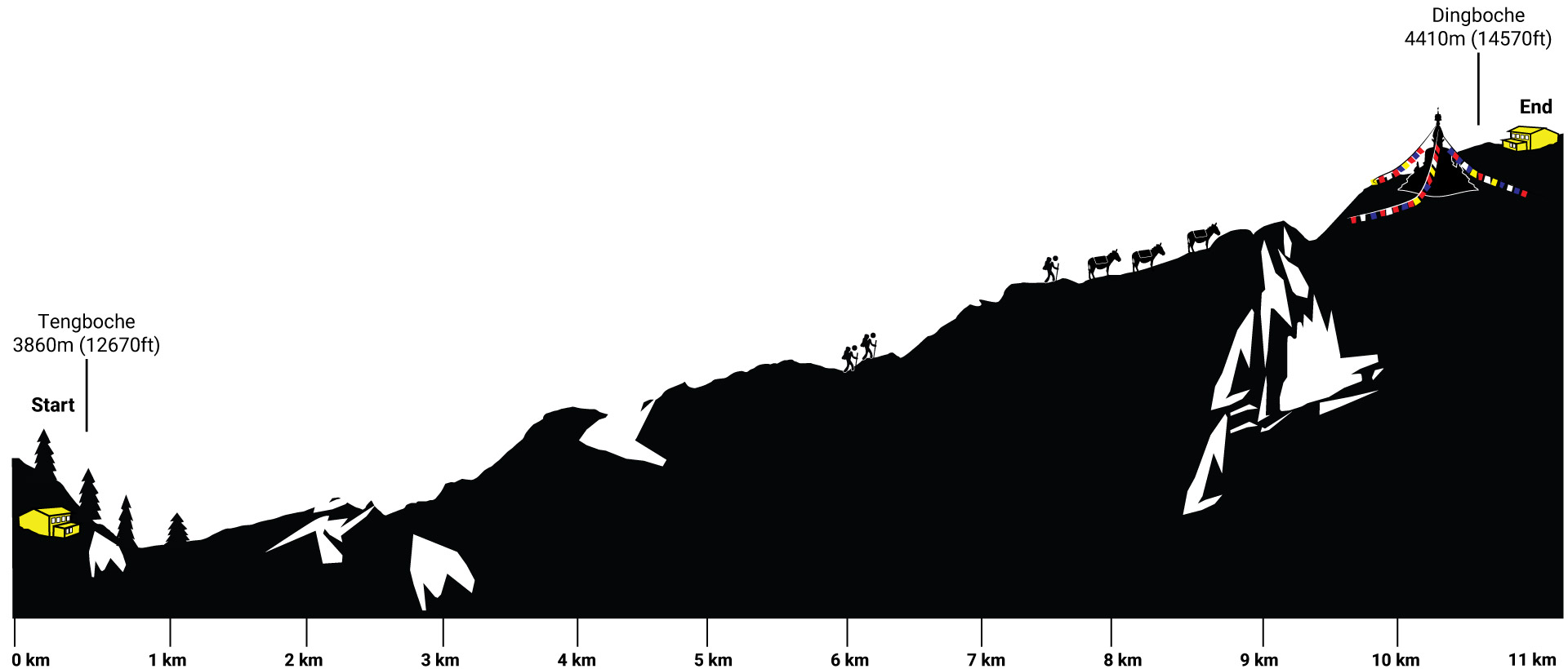

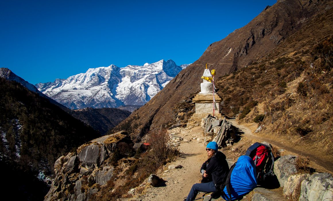
Tengboche
Namaste Tengboche. We both were super happy when the night finally came to an end. Our water bottles were frozen solid. Even with our down jackets on, with a completely closed sleeping bag, it was pretty cold. It was the first morning we both had a little headache. Since the hotel room was freezing, we packed our backpacks and started walking right away.
I was wearing my running gloves, but even with them on it was a frosty start. Before leaving the hotel, Bella asked for some water in the kitchen. But it was way too cold, and the water began to freeze the minute we were outside.
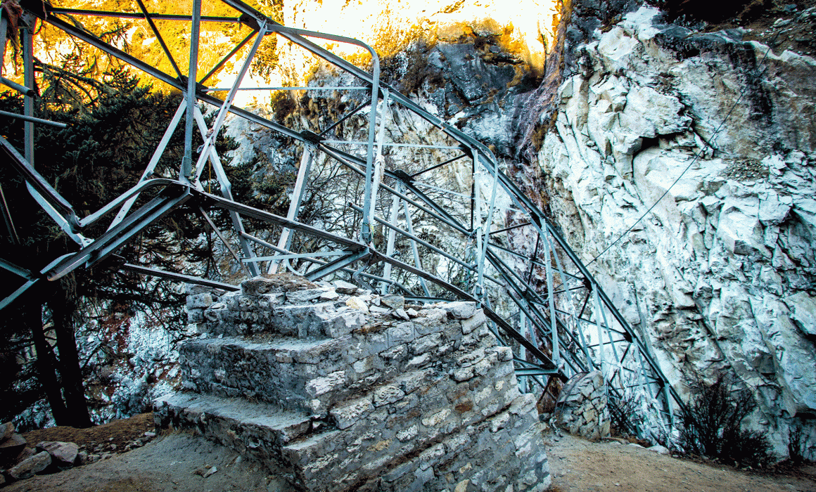
The ground was icy. We followed the path down towards Deboche, where the trail is split by a long mani stone wall. These prayers didn’t protect the village from the earthquake in 2015. We were saddened to see the nuns’ monastery was entirely destroyed.
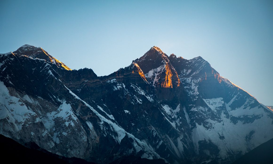
Throughout the mountains and valleys, there are constant reminders of the force of Mother Nature. The time we were there, the weather could not have been more perfect, freezing, but with a stunning blue sky – during this time of the year you can expect worse.
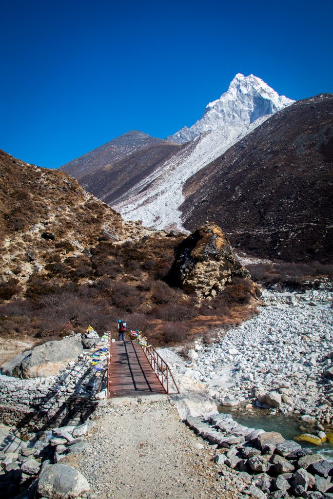
One of the bridges built on the trail has been washed out the season before. There was a small path leading us towards the new temporarily constructed bridge. The trail was narrow, and the snow close to the way didn’t make it easier. A few days earlier we saw a sign from somebody who went missing in the region. He fell into the icy river, and we didn’t want to follow, so we continued carefully.
Just after the bridge the path split, a Japanese couple with a guide took the turn to the right, we naturally followed them. But first we took a little break, the sun finally came out, and it was getting warm again. Perfect!
A few porters passed us; it is amusing how one of the porters is always carrying a phone or small radio with some traditional loud music. Most of the phones are old phones, which have one huge advantage compared to new smartphones: a battery that will survive for more than a day. This quality is even better when it gets dark during the night and you can’t sun-recharge your phone everywhere.
We continued, and the path quickly got narrow, before it completely disappeared. Maybe a rock or debris hit this part of the trail. It made a passing difficult. We climbed over the missing section… puh, we did it.
But just a few meters further into the trek the path disappeared again, this time even worse. We had to climb upwards for about 3 meters, there were just a few loose stones, which gave us support. The bulky backpacks made the climb, which required a lot of balance, really difficult.
Eventually, we were on the right trek again. I don’t know how the Japanese couple climbed this section, but I guess the missing backpack makes it a lot easier, or they just have hiking powers.
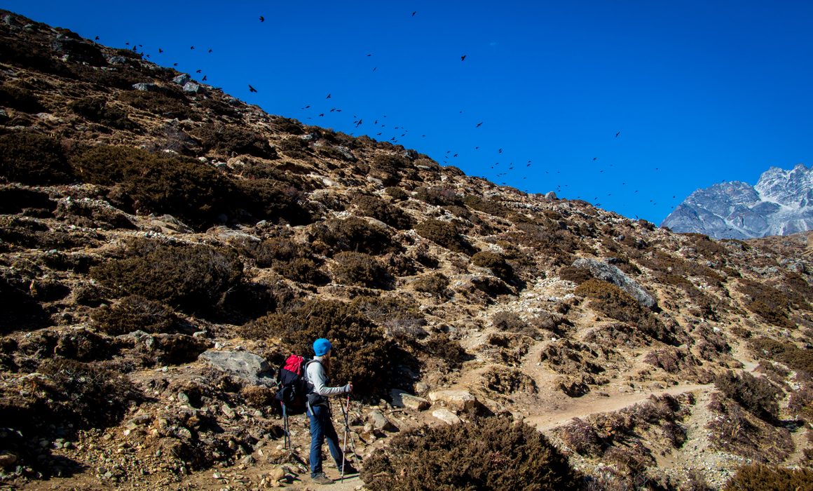
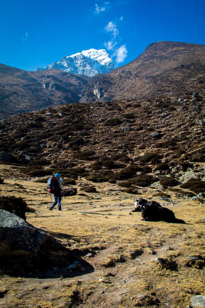
As we hiked towards Dingboche, we started to get more of an idea of the vast landscape we would experience during the next days – with broad valleys and winding streams far below the trail and even more spectacular views around each corner. There were just a few bushes on the path, the rhododendron and trees disappeared altogether.
Pangboche
We had lunch in the village of Pangboche. Luckily we found a lodge which was already opened. We met Pierre, a French hiker who was on his way down. He immediately invited us to join him for his late-breakfast MoMos. We had a nice chat, but we had to wait for nearly one hour to finally get our food. After that, we were in a bit of a rush to continue.
Just a little later, we met two Chileans and their guide, we knew them from our first day. So it was time for another break. They hired a porter, on the way up to Namche. It was just a bit too much weight on their back. They were a bit worried about my headache, so they provided us with some Diamox tablets.
I had the feeling that the headaches are more because of the cold water we were drinking all the time, so we ordered a big pot of tea, which was nice.


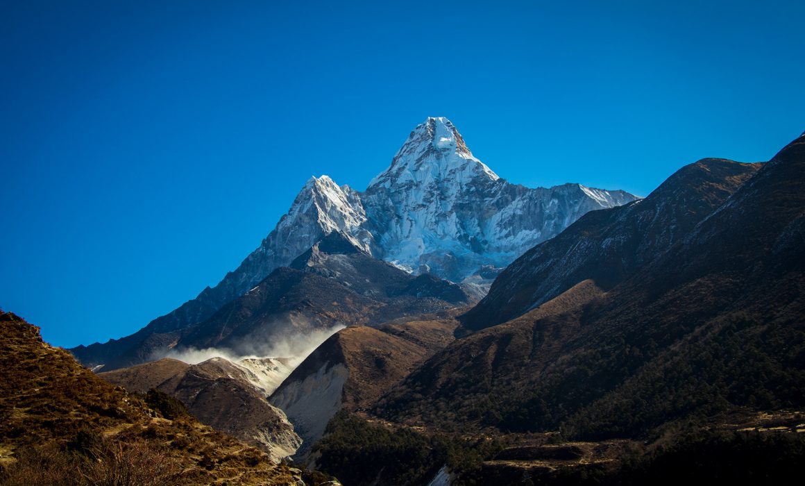
Ama Dablam
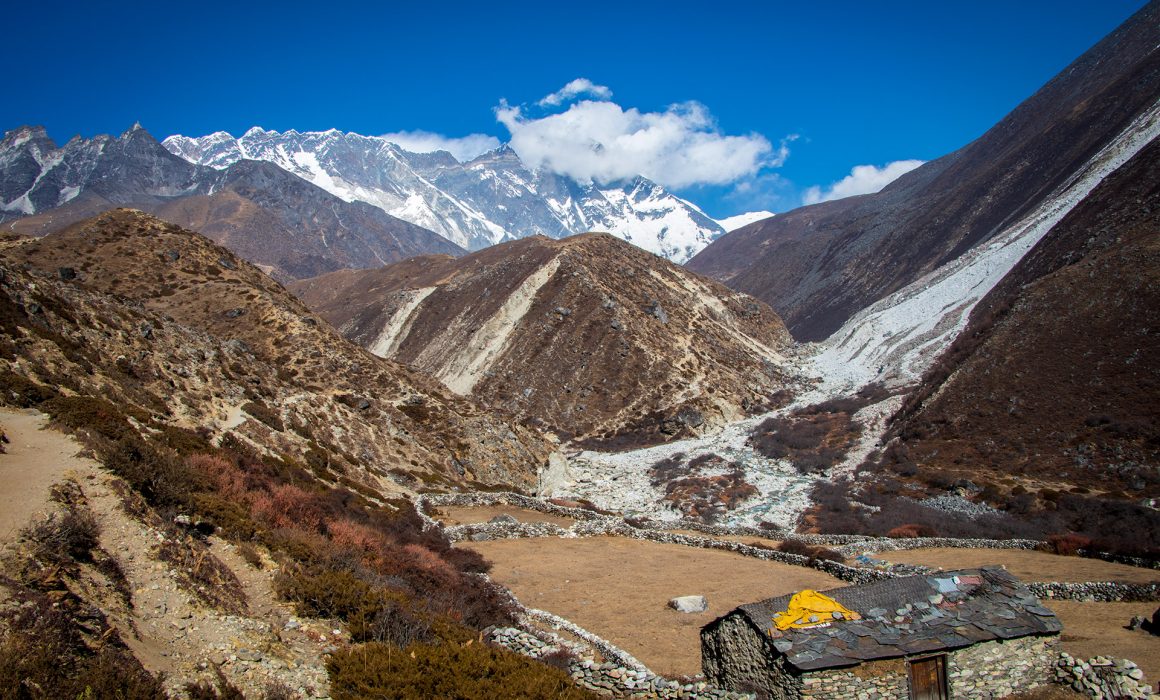
The trek was nearly flat and comfortable to walk. The Ama Dablam was now to our right side and changed its silhouette another time. The remains of a huge gravel avalanche were still visible. We had to cross the river again. In the distance, we could already see the farmlands from Dingboche with stone fences dividing each of the fields.
Dingboche
It was stunning scenery, the path was nearly flat. It was hard to believe that we were around 4.350 m and the mountains surrounding us were more than 6.800 m high. Dingboche is entirely surrounded by farmland, it must look amazing in spring, when the buckwheat, potatoes, turnips, and green leafy vegetables will dye the landscape. For us, it was just a gravel wasteland.

Yak Hotel in Dingboche
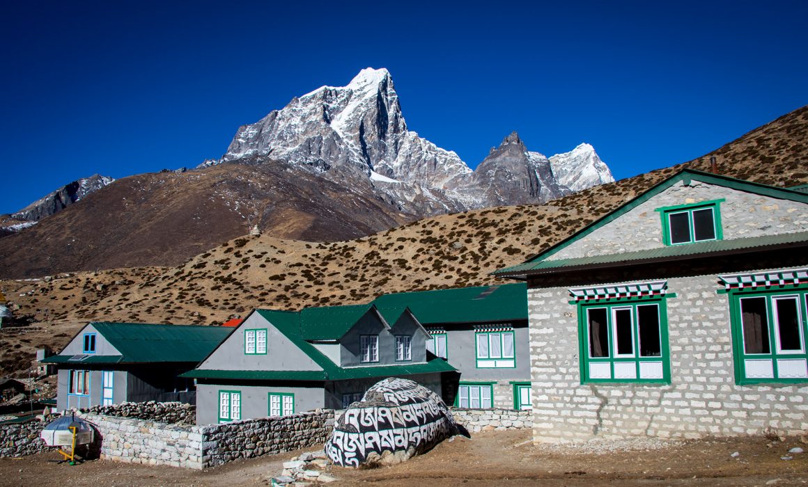
A few minutes later we reached Dingboche and stopped at the first lodge. What a pleasant place, and it wasn’t as cold as Tengboche the day before. The owners were super friendly, like always. The food was delicious as well. The perfect lodge for the next two nights.