Blog Archives

Madeira Day 2 Caniçal- Casa das Funduras

Madeira Day 1 | Caniçal- Casa das Funduras

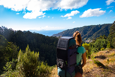
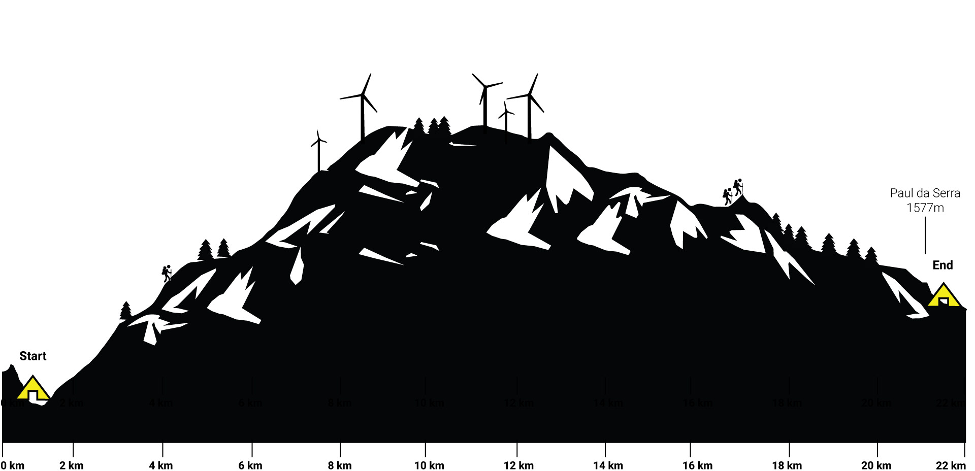
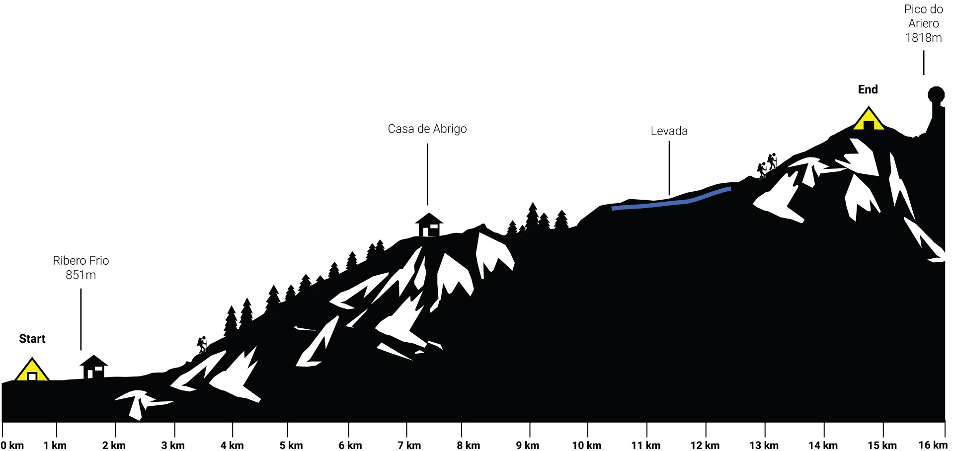
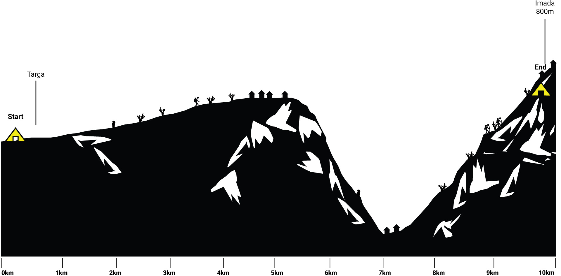
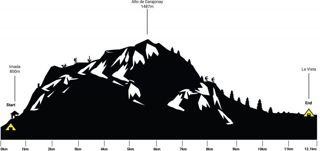
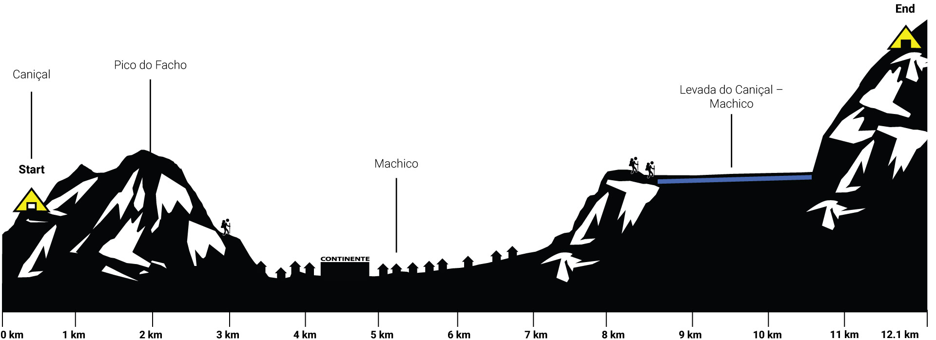
Hiking 12.1 km  Ascent: 762 m Descent: 329 m Max Elevation: 536 m

Accurate height profile

Click here to download GPX file

We started our trek at 10:00 am. The first few meters are simple. At the Museu da Baleia, you have to turn right and walk up the hill, till you reach the next crossing and turn left. At the Museu we realized that our GPS wasn’t set up properly. Our mood dropped to an unforeseen low.

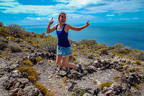
But this wasn’t the only thing we forgot at home. Bella’s hiking sticks were still in the basement. She was not amused… The GPS and the sticks were the hope she had to make this trip the smooth experience she was looking for. There we were: 2 motivated hikers without motivation at the shore of the Atlantic Ocean.

The only thing going through Bella’s mind: Arghhh, where are my sticks, where are my sticks…

The bleak landscape suited our mood. We started walking anyways.

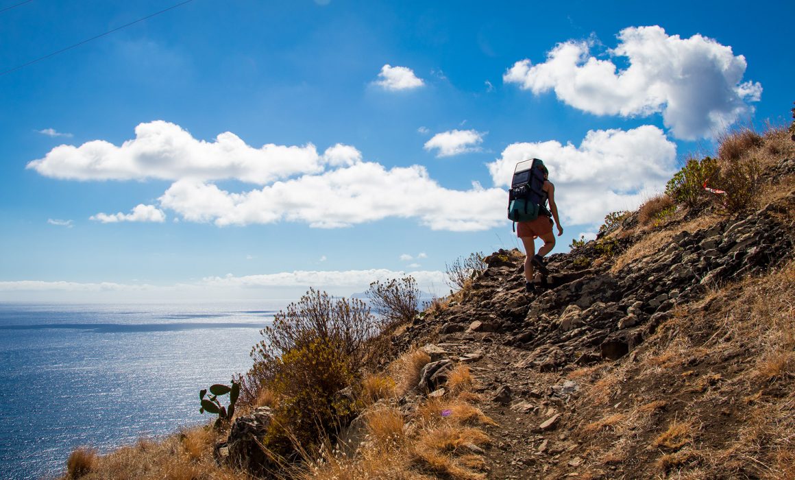
This short but demanding route traces one of Madeira’s historic roads, an old stone trail connecting the coastal settlements of Machico and Caniçal. The trail today is little-used and the former agricultural terraces that go along with it have been largely abandoned.

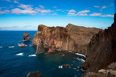
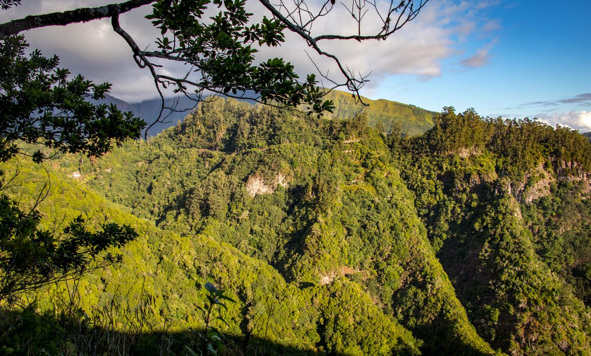
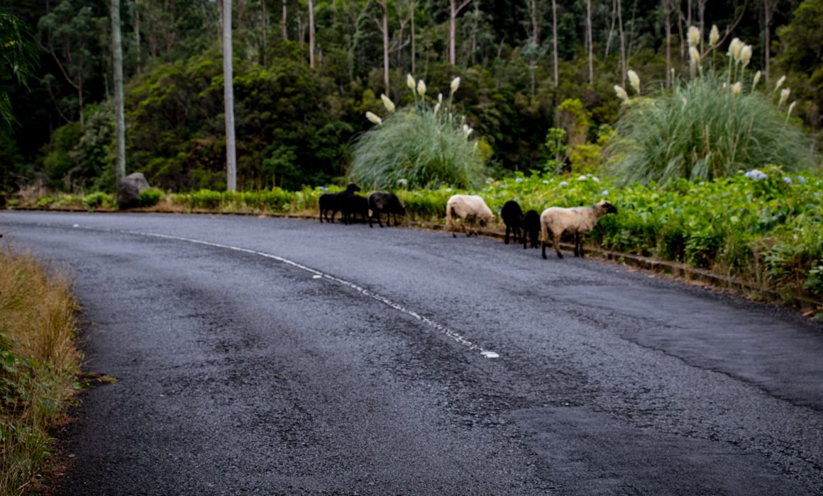
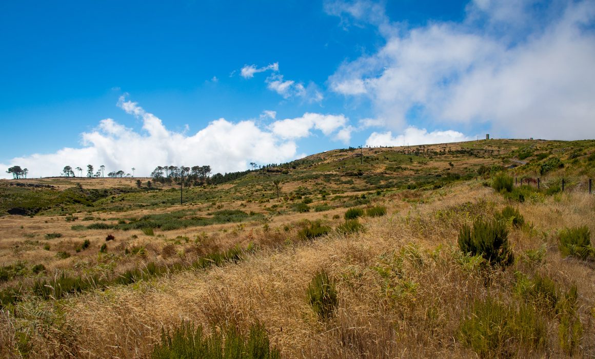
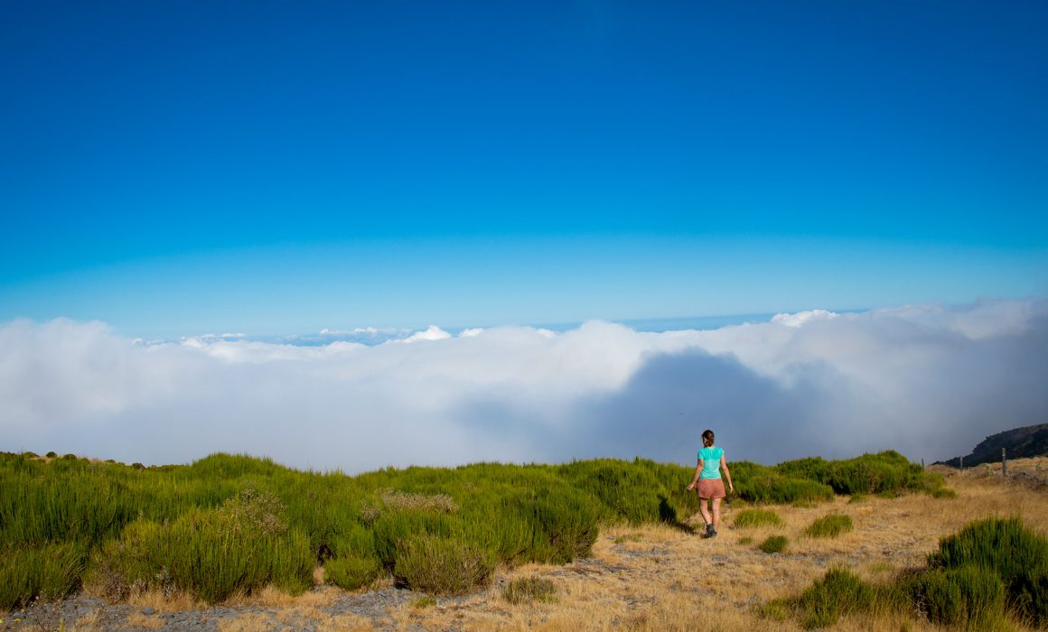
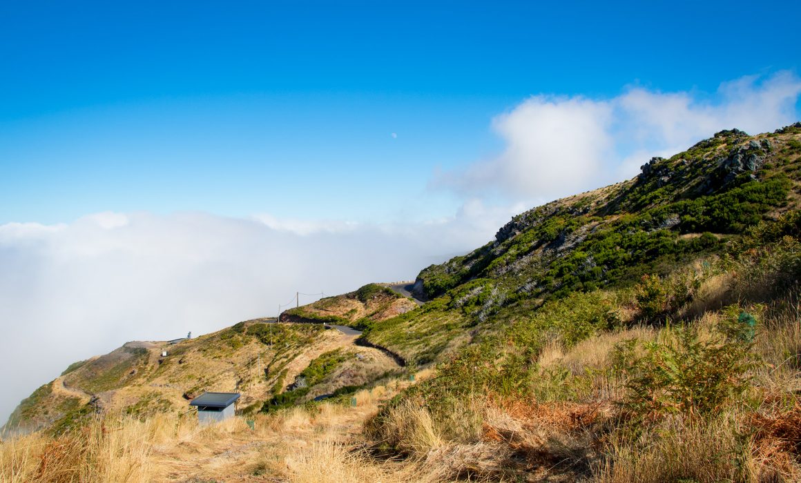
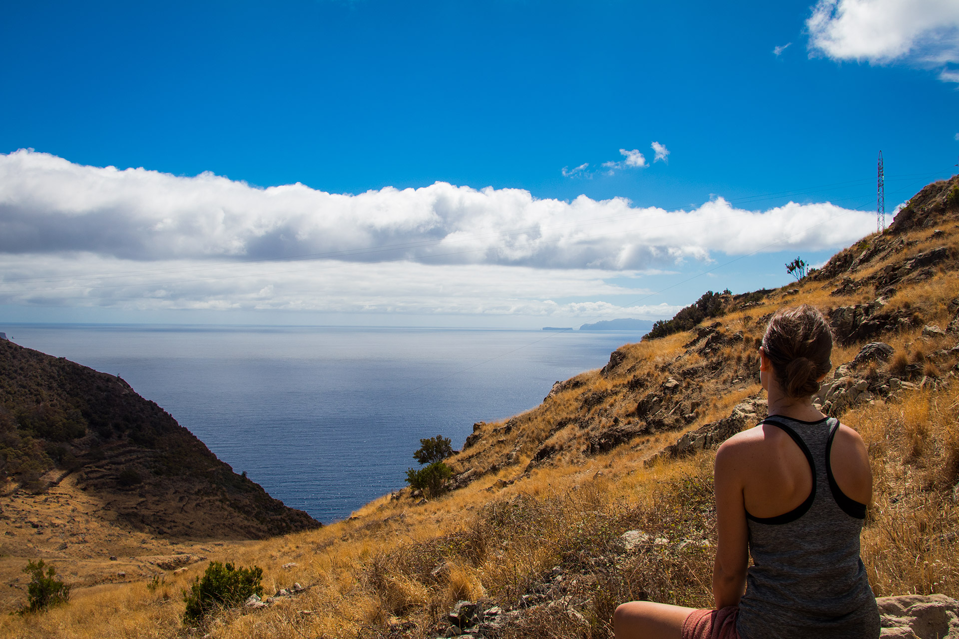
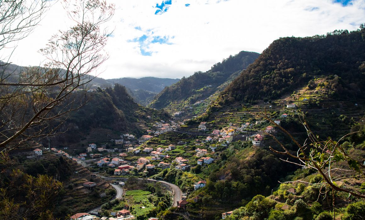
The lag of shadow makes the initial climb to Machico even more tiring. Just a few goats enjoyed the fantastic coastal views with us. We stopped every hour for a few minutes, to get used to the temperature and steep climbs. Shortly before Machico we reached the Pico do Facho. This viewpoint offers a wide view over the Machico valley. Reaching as far as the island’s central peaks and Ponta de São Lourenço.

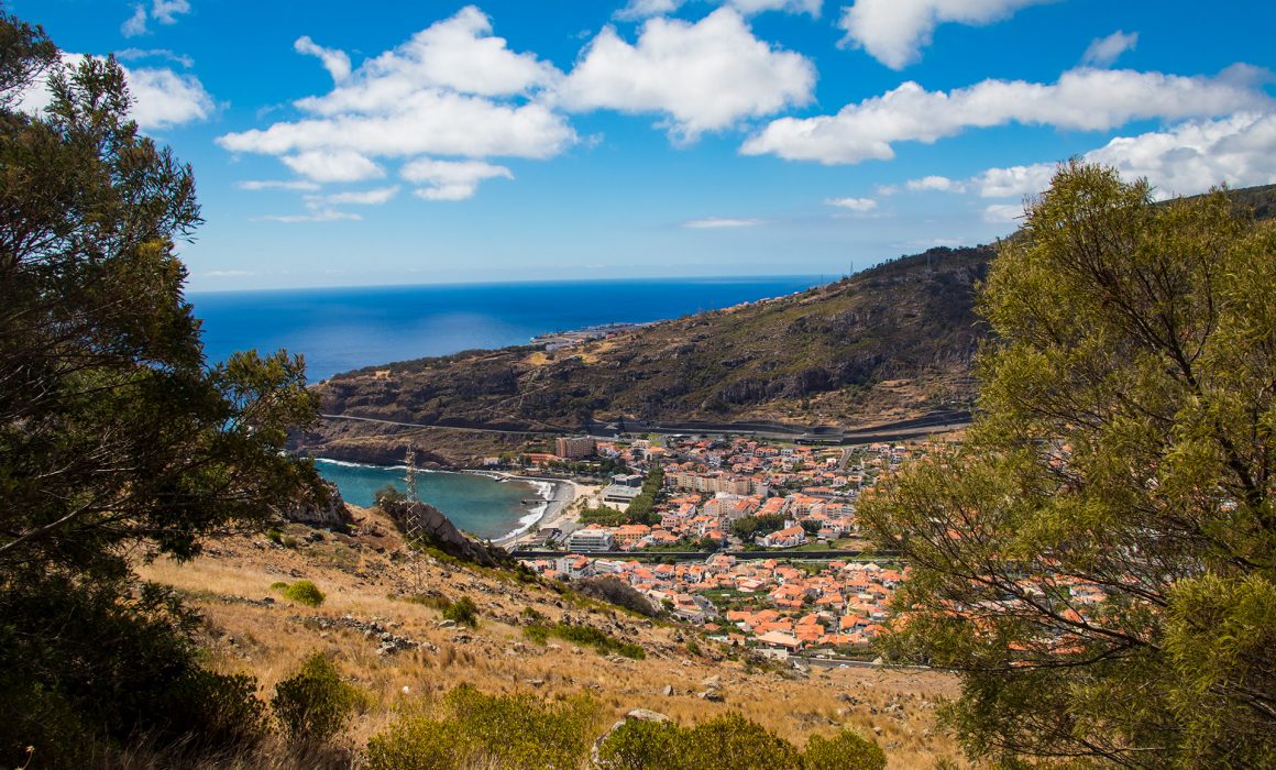
From up here we could already see our next destination the “Continente” in Machico. A huge supermarket. Machico would also be our last chance to find hiking sticks for Bella. We followed the streets and after a few hundred meters we turned left to descent to Machico, where the goat “Helga” welcomed us from far away. A small levada finally leaded us to the easternmost municipality on the island. One of many more levadas to come…

Many levadas are cut into the sides of mountains, but also go through them in tunnels.

We asked our way through to the Continente. Everybody was super helpful, even if they didn’t know where we wanted to go, they pointed in some direction. The small houses and stepped streets were absolutely picturesque.

At the supermarket we bought the last supplies (a lot of them) and had a small lunch break.

Then we started our search for a new pair of hiking sticks. We weren’t successful but the small detour gave us a perfect overview over Machico.

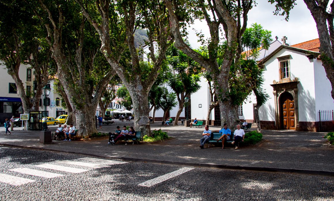
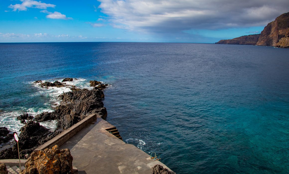
From the historic point of view, this is probably the most interesting town on the whole island. As Machico was the landing point of the discoverers of Madeira. The oldest church, the ‘Capela dos Milagres’, and two forts still bear witness of the locals’ defense against the pirate attacks on the village. Machico has a wonderful beach and good facilities for both swimming and sunbathing. But no hiking sticks, which sucks.

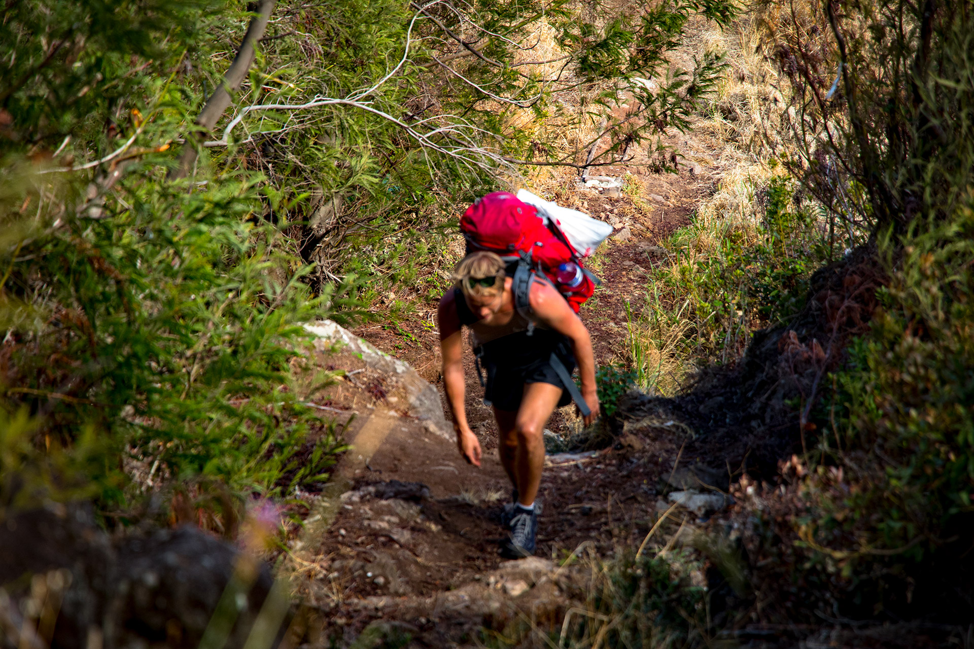
We continued our trail on the main road, which is divided by the Machico River, until we reach a roundabout. From here on, it was a really steep climb towards the “Levada do Caniçal – Machico”. We had a wonderful view over Machico. After a few meters on the trail, we had to take our backpacks of and continue on all fours. This can’t be the right way, so we turned around and searched for an alternative way. – It was tough

I even had to carry Bella’s backpack, since it was simply too steep.

Which meant: Hike up a couple of meter, set the backpack down. Walk down. Help Bella up. Walk down again and carry Bella’s backpack up. And again… Hike up….. I guess I am a true hero.

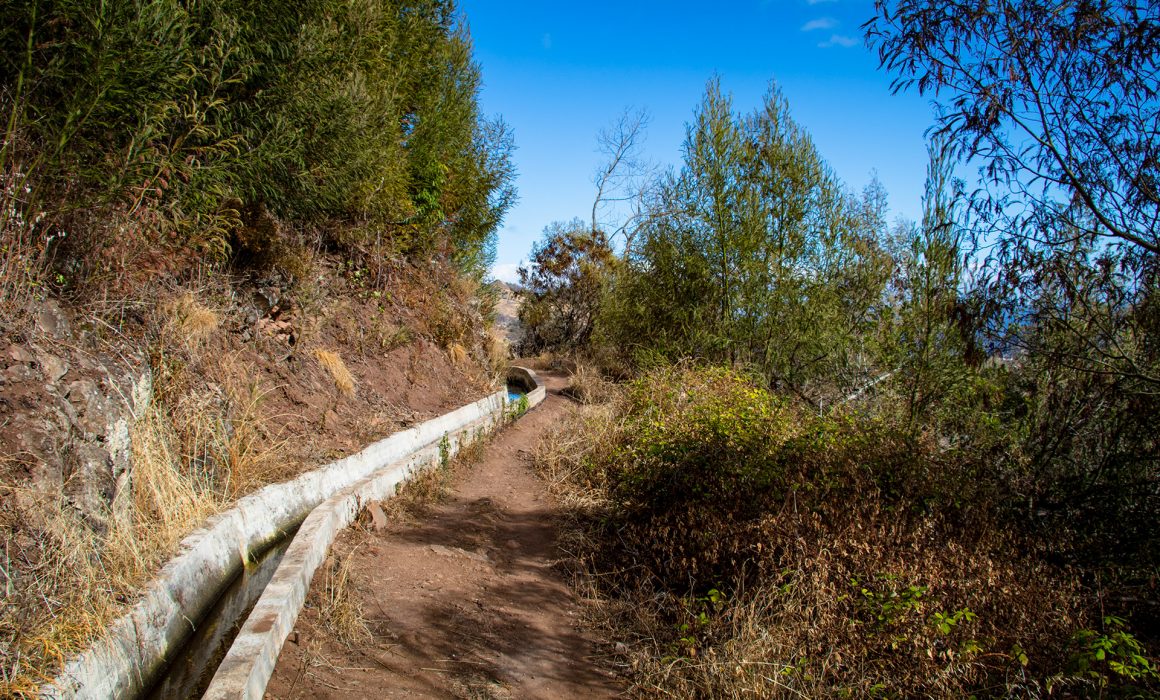
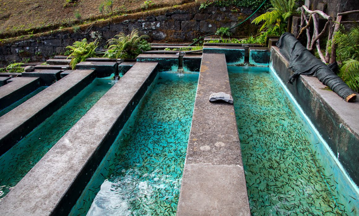
Finally the “Levada do Caniçal – Machico”. This Levada is super simple to walk.

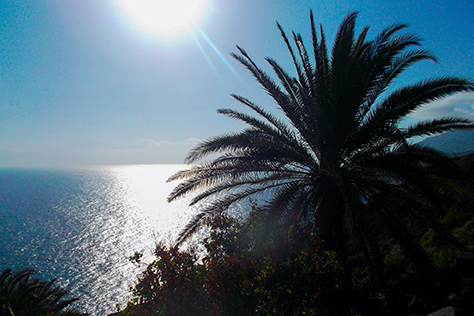
Along the way arise incredible views of the city of Machico, its houses and gardens and the vast Atlantic Ocean as a background. There are small bowls of fruits, along the path. Which you can take, in return of a small donation.

After just 1 hour, the 4 km long path was already over, where we passed our first tunnel as well.

The Madeiran on this stretch of the journey were incredible, friendly and courteous. Everybody wants to chat with you or talk about the beauty of Machico Valley.

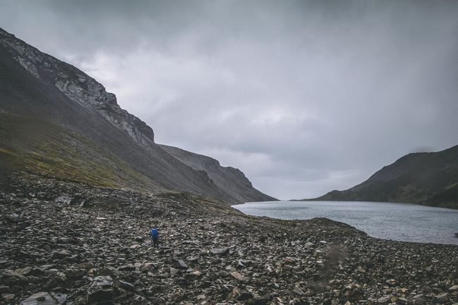
As we’ve reached the next street, we followed a small path up the hill, where an old man offered us a warm bed for the night. Sadly we had to decline to continue our walk upwards. He was a bit scared – it was already 5 pm – that we wouldn’t reach our destination. Bella explained to him, that we are carrying our home on our shoulders. That made him smile and he approved … Boa viagem! Many, many steps later, we reached a small pond. Time for a break.

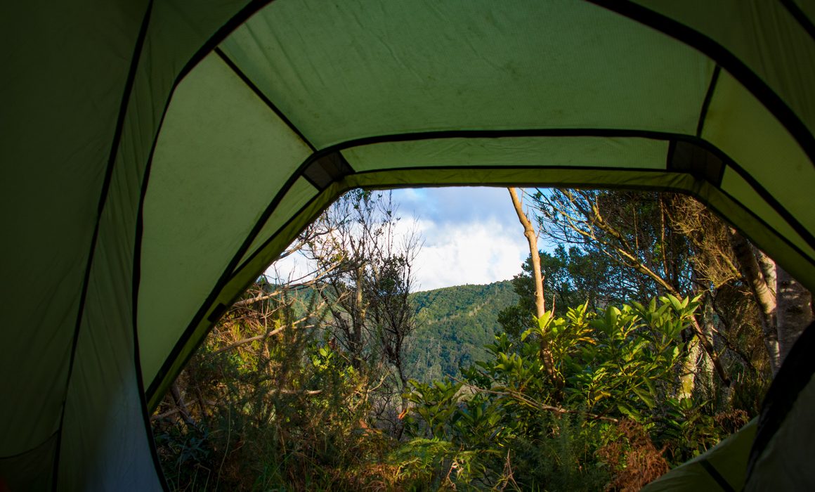
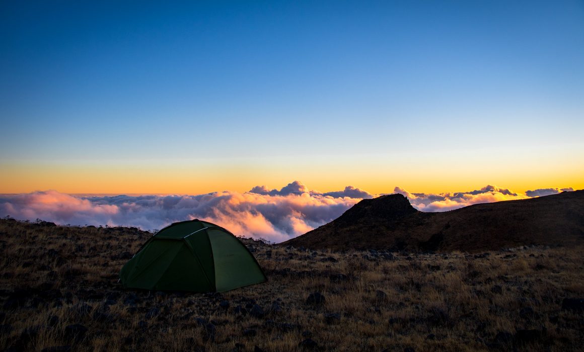
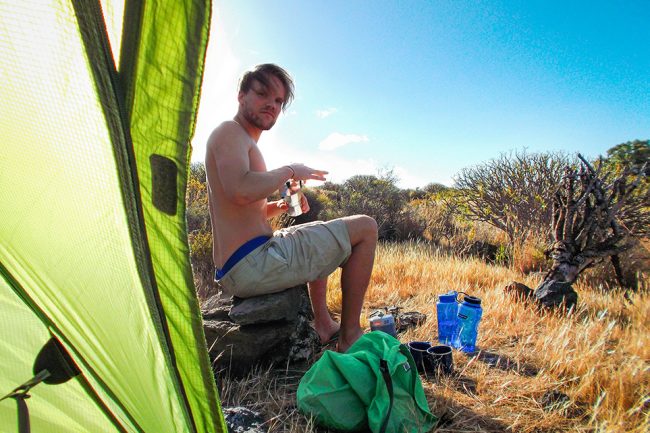
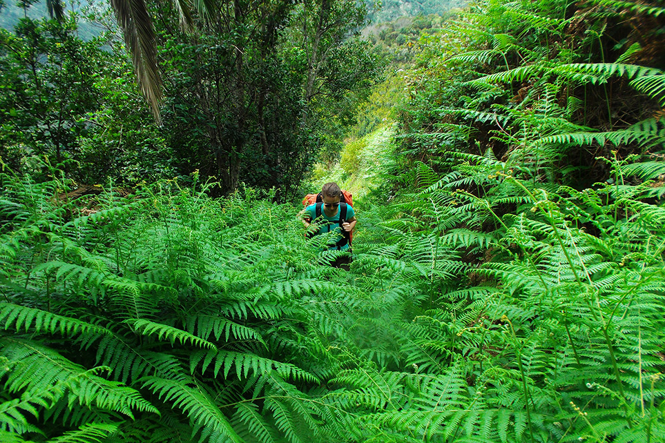
The path leaded us into a forest and after a few hundred meters we reached our camp site. The stepped path continued towards the Casa das Funduras (PR5) but not for us, at least not for today. A perfect spot for the night. We didn’t follow the sign “Casa das Funduras” and continued walking on the path until we reached a dead-end.

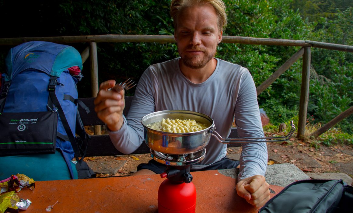
It was finally time for a cold tortilla de patatas. Over a game Yahtzee, we while away the evening.


Day 1
General Info
Day 3
Day 1
Info
Day 3

Leave a Reply!

Leave a Reply


more adventures…


Madeira Day 7 | Paul da Serra – Porto Moniz

Madeira Day 7 | Paul da Serra – Porto Moniz

Hiking 13.8 km  Ascent: 200 m Descent: 1360 m Max Elevation: 1196 m

Accurate height profile

Click here to download GPX file

Goooooood morning ………..Cows. What the hell. We are surrounded!!!!

We both woke up pretty early. There were some weird noise, coming from outside.Bella and I were both pretty scared, after open the tent it was clear. The cow herd surrounded us. It was a trap.

madeira cows

Since the cows where eating outside, we had our lunch inside. Spaghetti Bolognese, don’t worry all cows are still alive… Real Turmat makes amazing food. The best we ever had, but also not cheap. We used Bella’s new camping dish. ☺

We had to make two coffees today, because I kicked the coffee pot during the first attempt. After a small discussion, we decided to go outside and take our tent down, super slow.

madeira camping paul da serra cows

The only downside was, it was still raining and our tent was a pool, again.

We followed the road, the weather was a bit depressing. Earlier we refilled all bottles, because we were scared that we run into the same problem, than the last two days.

The PR 13 which should leads us to Ribeira de Janela, was wonderful. The landscape looked like New Zealand. Gently curved mountains and huge dreamy trees. Lush meadows with cows grazing near the trail.

madeira paul da serra

It was so pretty that we didn’t real pay attention, where we were heading. We followed the GPS blindly.

Suddenly the trek was going down like hell. 30° degrees!!!!! I though, today it will be a nice easy walk down. The GPS said we were still on the right way, but it didn’t felt like this.

The Path continued like this for an hour, I even had to make hiking sticks for Bella, because it was simple to steep and no end in sight. The trail was just an old river bed and it seems that had done the trail in ages. But we were committed.

madeira laurisilva

Solid 4h 30m later we reach the end of the “trail” and what we tough Porto Moniz. At a tap, we made our self “civilization ready”. Being clean felt great.

But “Porto Moniz” looked completely different than we expected. There wasn’t any natural swimming pool and it was also really tiny. Slowly we realize that our adventure wasn’t over yet. We were in the wrong valley.

madeira jungle

I was getting angry … what happened. I started yelling at Bella. We both walked down into the valley. During our descent Bella checked the GPS once more.

Yesterday night, we change the Profile from hiking in to climbing. Which means that the GPS is searching for every climb, it can offer and goes for it. What a disaster. The only upside was, that there was a huge street connecting Porto Moniz with Ribera de Janela.- Through a tunnel, a big one.

madeira ocean

Reaching the bottom of the valley, we realize that there is a small path right at the ocean connecting the two towns with each other. Luckily, we didn’t had to go through the tunnel, which would have been scary.

The final few kilometer passed by so quickly. We both were super happy to finally reach Porto Moniz. We did it, at the town sign, we knew nothing will stop us know. Our backpacks didn’t feel like 18 kilos anymore. What an epic adventure.


Day 6
General Info
Day 2
Day 6
Info
Day 2

Leave a Reply!

Leave a Reply


more adventures…


Madeira Day 6 | Boca da Encumeada – Paul da Serra

Madeira Day 6 | Boca da Encumeada – Paul da Serra

Hiking 22.4 km  Ascent: 696 m Descent: 556 m Max Elevation: 1577 m

Accurate height profile

Click here to download GPX file

tent view

Day 5 of our adventure started with a disaster. It was raining the whole night. The moment we woke up our Vaude tent, which we loved for the last couple of year, was a swimming pool. Everything on the ground was soaking wet. Our passport, the camera, everything ….

vaude wet tent

We decided to just stand up, pack our staff and start walking. It was cold, the wet clothes didn’t make it any better. But what is an adventure without a proper disaster.

The plan was to walk in the direction of Vargem, but because of the bad weather and slippery ground, we had to change our plan. The new plan was to follow the ER110 until we reach the Paul da Serra. First we needed some energy, at the bus station, was a small restaurant. Where we ordered bolo de caco and coffee.

paul da serra view break

Back on the street, everybody was staring at us, the 11,2 km towards the Paul da Serra were hard. Especially in the rain, but after the last days, it was kind of normal. The only problem was the rain and the fog. A couple in car, asked us if they should bring us up to Paul da Serra. We meet them on our first day in Caniçal. But we want to complete the east – west crossing by foot. Everybody was starring or honking at us, to cheer us up or maybe because we walked on the road.

In general it wasn’t so bad. In tunnels we had to wear our headlamps, to be visible for the upcoming traffic. When we reached Paul da Serra, the rain stop and the clouds slowly disappeared. Huge windmills appeared from nowhere.

Paul da Serra is an in-between. A plateau between the south and the north of the island, a unique place, out of time, out of space, another face of this incredible island.

paul da serra street

It was still cold, but the rain finally stopped. We reach a few small house were we had a lunch break. There were a lot of fire place close to the street. We regretted not having any fresh meat with us. They even had running water. 4km into Paul da Serra, we left the street and reached a small forest. After passing a levada the forest opened. It was getting really hot and we took out the tent and our wet stuff to let it dry in the sun.

paul da serrra forest

But the good weather was short-lived. Paul da Serra disappeared completely. We continued walk with no view at all, a fog wall in front of us. Our water was running low. Bella spotted a Levada passing by  – on our GPS. After half an hour of searching we finally gave up.

Orientation without indication, wasn’t simple and a bit scary. This went on for hours, suddenly we reach the street – by accident. It was easier to walk on the street, we though, we will kill a few kilometer on the main street.

madeira paul da serra fog woman

Suddenly two French BMWs appear. A couple of guys were shoot a movie. But due to the bad weather condition we couldn’t see anything.

At every rest area, we searched for water, without any luck. Our feet where hurting, we could feel the 21 km we already walked. Leaving the main street once more, we followed the PR 13 towards a lookout point. The view was amazing … a lot of clouds combined with even more clouds.

paul da serra street fog

The way down, was really slippery and wumps I felt down. But I didn’t hurt myself.

Luckily we found a water hose, my plan was to let the water run for a couple of seconds and the refill the water bottles. Good in theory, but after a few seconds there was no water left.. The hosepipe followed us for a few hundred meter … as if it wants to say: “this is what happens, if you waste water”

We walk really careless, which wasn’t so smart. The trek was amazing, it was like walking through a fairyland. Moss and fern was hanging from the old laurel trees and the fog was doing the rest. Finally, after crossing the street wants more. Bella spotted a clearing and even better, a water tap with running water. –thank god

madeira laurisilva

It looked a bit like a cow’s pasture but better than nothing. We pitch, our still wet tent, on a spot without cow dung. It was time for dinner. Bella thought we are out of food. So I convinced her, that I had to search for blackberry to make some food. She didn’t knew that I had some happy birthday Chicken Tikka Masala with me. – Astronaut food

The best instant food we ever had. We even made the dinner in our tent. It was too cold outside. After finish eating, we took the camping cooker inside and heated up the whole tent. We anyway had too much gas left. Bella was playing around with our GPS device, which will have a nice side effect tomorrow. –never change a running system

madeira cocking real turmat

After a few minutes it was getting really hot and the lack of oxygen was doing the rest. We dried our wet clothes in the top section of our tent. It was like a small sauna.

A few minutes later we went to bed. But just for a few minutes because it was Bella’s birthday.After unwrapping her presents, we quickly fall asleep, again.


Day 5
General Info
Day 7
Day 5
Info
Day 7

Leave a Reply!

Leave a Reply


more adventures…


La Gomera Day 1 San Sebastián – El Cabrito

La Gomera Day 1

San Sebastián – El Cabrito

Hiking 7.6 km  Ascent: 349 m  Descent: 334 m  Max Elevation: 155 m

Accurate height profile
Click here to download GPX file

Los Cristianos

We arrived at the Tenerife North Airport, from there we took the bus to Los Cristianos, where our ferry departed to La Gomera. The bus ride took about 1:40 hours along the beautiful coast of Tenerife. The island has so many different landscapes, there are beautiful palm trees and plants in the cities, whereas the rural area has unvegetated and barren landscape, which is nevertheless fascinating.

We arrived at our Hotel Suites at the Beverly Hills in Los Cristianos later that evening. It was nothing special but worth the money. The climate in the evening was really nice, it wasn’t too hot and people where sitting outside their hotel rooms and drinking loads of alcohol.

los cristianos tenerife ferry wanderlust
los cristianos tenerife ferry

The next day we woke up early to make our last purchases before we started walking. Since it is forbidden to carry gas tanks on aircrafts, we bought some camping gas for our Primus camping cooker at the Ferretería Caride Hardware shop in Avenida Amsterdam. If you need some other gear this might be the right place to do some last camping shopping.

We bought a small Digital Camera at an electronics store on the main shopping street. The whole town is dominated by Russian and English tourists, so if you are up for an English breakfast you will find one on every corner.

la gomera ferry tenerife

Ferry to La Gomera

There are two different ferries to La Gomera. The Fred Olsen Express, which is a Catamaran, will take you there in 40 min – we decided to take this one on our way to La Gomera, which we regret, since the jet engine of the catamaran is destroying a lot of sea life. The second ferry is the Naviera Armas Ferry which we took on our way back (it’s also a bit cheaper).

la gomera ferry

A few dolphins followed us during our catamaran trip and we could get an amazing view of the Mount Teide with its 3.718 m (12,198 ft) summit, the highest point in Spain and the highest point above sea level in the islands of the Atlantic. A breathtaking view.

After 30 minutes we could see La Gomera and the adventure laying in front of us. Woo-hoo. The island is very mountainous, steeply sloping and rises to 1.487 meters (4,879 ft) at the island’s highest peak: Alto de Garajonay. The shape of La Gomera is rather like an orange that has been cut in half and then split into segments, which has left deep ravines or barrancos between them.

San Sebastián

After the ship has landed we walked to the first gas station and bought a hiking map of La Gomera. Now it was time for the fun part, buying food and supplies for the next few days. Woo-hoo again. The Tu Trébol La Gomera close to the bus station is a huge shop where you can buy everything you need for little money.

We bought our first La Gomera avocado, it was amazing and the taste followed us for the next few hours. A can opener for the Ravioli we bought was also on our shopping list and of course a lot of instant soups, noodles and cereal bars for the hourly breaks. The difference in altitude on La Gomera shortened our walking time to 50 min and extended the break time to 10 min as we progressed walking on the island.

la gomera san sebastian

The first day of the La Gomera Adventure took us from San Sebastián to El Cabrito. We started in San Sebastián which was founded  by the Guanches, the native people of Gomera before the arrival of the Spanish. Hernán Peraza arrived in 1440. Christopher Columbus stopped at the harbour on the 6th of September 1492 before heading to India but arrived in America instead.

The remanings of the war between the Guanches and Spanish Conquistadors are still visible in the middle of San Sebastian at the Torre del Conde, where one of the final battles between the native and Spanish took place.

la gomera kiss

GR132

We followed the beach promenade until the crossroads (Calle Dise), the road shortly ended and became a gravel path. Quickly we were 130 m above sea level. The red of the vulcanic rock, the sparse green vegetation and the blue of the Atlantic ocean created a wonderful scenary.

Now it was time to follow the GR132 (marked with red and white stripes).

We could feel the pressure of our backpacks on our shoulders, maybe we packed them slightly wrong.

A  equal weight distribution between the two of us wasn’t feeling right. Maybe it would be better if I carry some of the heavier parts of the equipment. But for the first day we left it like we started.

la gomera backpack

Monumento al Sagrado Corazón de Jesús

After 20 minutes we reached a small crucifix from where we had a wonderful view above the harbor and San Sebastián. Above us the Monumento al Sagrado Corazón de Jesús, an 18 meter sculpture blessing the bay of San Sebastián – it is also called the Christ of San Sebastián.

The next two kilometers passed by quickly. But the sun was brutal, no shadow at all and the shoulder straps rubbed the sunscreen from our shoulders. During every break we reapplied sun screen, our moms would have been proud!

We crossed the Barranco del Revolcader which during summer time was a dry riverbed and started the climb towards the El Veredak plateau (150 m). Now we realized our trip will be a constant up and down.

That is why the Guanchen invented El Silbo or »Gomeran whistle« a whistle sound which helped the Guanchen to communicate across the deep ravines and narrow valleys that radiate through the island. It enables messages to be exchanged over a distance of up to 5 kilometres. You can still hear the whistle sounds in some parts of San Sebastian where it is teached to the younger generation.

la gomera beach stones

Playa de la Guancha

From El Veredak we got a glimpse of Playa de la Guancha, a beautiful beach between El Cabrito and San Sebastián, it looked like a wonderful black sand beach from up there. But as soon as we started climbing down we realized that the sand wasn’t sand but instead huge black stones. Anyway a place worth resting for a couple of minutes.

la gomera ocean atlantic

We walked on a small sand path, next to us where some abandoned reed houses and caves (ah the caves) towards a lonely small white house. Close to the shore we found a nice place to rest, it wasn’t that comfortable but ok, until a hippie started to mark his territory by stretching his penis towards us and walking up and down.

That wasn’t our spot any more, time to leave.

la gomera nature pure

A short walk inland we reached the next and final climb for the day.

It was a steep climb, 150 meters in elevation. We realized we might have taken a wrong turn. Our hiking guide offers three different levels of difficulty, the blue (easy) the red (intermediate) and the black treks (hard).

This was a hard trek and our 15kg backpacks did the rest. We both were feeling dizzy. After 20 minutes of climbing up, we reached the top of the Barranco. “Can we really cross the whole island without any help?“ was going through our minds. But with just the descent in front of us we had to push forward.

la gomera valley nature

Ironically a young runner was passing us at high speed during our way down. I was jealous. In the Barranco we didn’t follow the GR 132 sign and headed inland to search a camping spot. Close to a wild donkey we found the perfect spot for the night.

Hidden behind a Canary Island dragon tree and out of sight of the Hotel Finca El Cabrito, our tent blended in perfectly. We were quite happy that we didn’t buy the orange tent.

la gomera camping zelt

After dropping the backpacks and pitching the tent it was time for dinner and a coffee. Ravioli à la casa or shall I call it Ravioli à la tent, anyway it was amazing (and 800 grams less for the next day). Bella was wearing her pink running socks in her flip flops – my fashion queen.

la gomera ravioli cooking

It was 8 pm and a long exhausting day turned to an end. After a few hours we heard loud screams from outside the tent. Some animals were screaming “nein, nein, nein” german birds??? It took us a few more days to find out what was making this noise. – More on this later…

I just remembered that there isn’t any dangerous wildlife on La Gomera, so we both tried to catch some sleep.

Day 1
General Info
Day 2

Day 1
Info
Day 2

Leave a Reply!

Leave a Reply


more adventures…


Madeira Day 4 Ribeiro Frio – Pico do Arieiro

Madeira Day 4 | Ribeiro Frio – Pico do Arieiro

Hiking 16.2km  Ascent: 1080m Descent: 192m Max Elevation: 1818m

Accurate height profile

Click here to download GPX file

After 30 minutes we arrived in Ribeiro Frio, the trail so far, was super simple, wide enough to walk next to each other and enjoy the views.

Arriving at Ribeiro Frio, we had a coffee at the local restaurant. The Tourist busses were arriving almost every minute. It was a pleasure, to see the tourist despair, with their hire cars at the steep road.

In Ribeiro Frio Forest Park you can observe the interesting Ribeiro Frio Aquaculture station, with its “arco-íris” (rainbow) trout nurseries aimed at the production of trout to replenish the water lines of Madeira. The whole Station is about 860m long.

From here on, we used the Levada water, for cooking and even drinking without any purification tablets. Now it was time to conquer the central massif. There is an old road, which can be used for the first kilometers. We followed the cobblestone path, through the laurisilva forest. Next to us a calm rippling stream.

We gained elevation pretty quickly. Faster than we can thought, we found our self in huge cedar forest. The ascent towards Pico do Arieiro was a beast, in 13 kilometers we gained 1km in elevation. In the middle of the forest, a few goats followed us. The motorists cheered us. There are not so many backpackers carrying everything by their own. Especially not on this stretch.

In Poiso we made a little lunch stop. –Asia noodle snack time

At the Casa de Abrigo do Poiso, we bought 2 bolo de caco, a typical sandwich. This nice restaurant was the first and only shelter, if you wanted to cross Madeira from south to north in the past. Which was a difficult thing to achieve. A lot of famous people spend a night in this shelter.

There is a public water tap in a small park. Where you can refill your water supplies.

We walked back to the roundabout, we crossed earlier. Following the sign “Pico do Arieiro” which at 1.818m is Madeira’s third highest peak. We just walked cross country. After 1.5km we reached a small picnic area, from here we followed a Levada towards Pico do Arieiro.

It was one of the nicest stretch of our adventure. We ate our bolo do caco and as dessert we had wild blue- and blackberries from bushes next to the levada. The views were breathtaking and the bolo de caco we bought earlier was even better.

Africa. The views are stunning with clouds floating over the beautiful mountainous rock formations – it’s just impossible to describe. When the weather permits, the south coast, Curral das Freiras and even Porto Santo can be seen from here.

Crossing a huge “savanna-like” plateau, we had a wonderful view towards the south coast of Madeira. The destruction of the fires, earlier this year (2016) were visible from up here. There were no trees sanding, everything was burned down. It looked like god was playing spelicans, tress trunks were lying everywhere. A sad thing to see, but you could already see the nature was coming back.

Another 30 minutes later, we reach a small peak, in front of the Pico do Arieiro. The perfect spot for the night.

After hiding our backpacks behind a few rocks. We climbed to the top of Pico do Arieiro and bought a few beers at the restaurant.

Arriving back at our campsite we pitched our tent and while away the evening. For dinner we had spaghetti carbonara.

A perfect day.


Day 3
General Info
Day 5

Leave a Reply!

Leave a Reply


more adventures…


La Gomera Day 4 Targa – Imada

La Gomera Day 4

Targa  – Imada

Hiking: 9.7 km  Ascent: 451 m  Descent: 359 m  Max Elevation: 811 m

Accurate height profile
Click here to download GPX file

We started early in the morning to avoid the hot midday sun. It was a slow and steady ascent. A huge red and white telecommunication mast was always in line of sight. Besides a few palm trees and cactuses there was barely any vegetation. After just 4 km we decided to make a small break, two big palm trees were the perfect spot for our hammock. While attaching the rope to the palm trees, the whole rope became black: huge parts of the palm trees where burned from a recent fire.

The view was amazing from up here (750 m), the whole ocean became a miniature wonderland. With small toy sailing boats bobing up and down. The deep blue of the Atlantic Ocean is still fascination to us and cereal bars taste even better in a hammock. If someone could serve us a beer the world would be even more perfect.

Targa

It was time to begin the final ascent to Targa. 30 minutes later we reached the quiet village, unfortunately there was no supermarket or other store to buy supplies, so we had to push forward. We had two options to hike to Imada, an easy walk without any height difference or a brutal way down to Guarimiar and then up again to Imada.

Descenting to Guarmiar

We chose the difficult path. The descent was crazy. The path was dropping down, while it wasn’t possible to see the path in front of us. After 1.6 km that felt like an eternity, we reached the bottom of the barranco and Guarmiar. Our knees where hurting from the steep climb downwards, but there wasn’t time to rest.

The ascent was just like the descent, crazy. With our 15 kg backpacks we slowly climbed upwards.

We heard a few people coming down the path, laughing and enjoying the hike. A group of older french hikers was passing by. Bonjour …. and they were gone already. Hiking without heavy backpacks must be amazing.  The laughing made us optimistic that the ascent will become easier. The volcanic stone formations truly show the force of nature that once formed the island.

Imada

The valley looked amazing and the temperature wasn’t as hot as on the ridge. Soon we could see Imada popping up in the distance. Before making the same mistake twice, we began to search a camping spot outside of the town. The fast rising hills made the search complicated. Finally we found a nice spot on an old terrace, we hid our backpacks in a bush and walked into the village. Well, we were jumping actually, without the backpacks everything was feeling easy, and we could enjoy Imada even more.

We found a small bar in the middle of the village, Bar Cefeteria Arcilla. We ordered Papas Arrugadas with Mojo and two beers. The perfect pre-dinner after a long hike. For a late night snack we bought more beer and some chips.

On our way down we were already a bit drunk, so we ran downhill while laughing ridiculously. The location of Imada, in connection with the breathtaking view into the pictorial landscape, obtains a feeling of boundless liberty.

After a few more beers the night was approaching and it was time for another meal. During my childhood vacations with my family, where we stayed at a campground in Greece for 6 weeks every summer, we had 2 standard meals, Menu 1 and Menu 2 … maybe there were more, but this is all I can remember. In Playa de Santiago we bought all ingredients for Menu 2: Corn, Creme, Corned Beef, Noodles….. and all cooked them all IN the tent. (Never do that!)

I was in childhood heaven. Combining this particular taste with the sound of a tent zipper made me a little boy again.

Time to call it a day …


Day 3
General Info
Day 5
Day 3
Info
Day 5

Leave a Reply!

Leave a Reply


more adventures…


La Gomera Day 8 Vallehermoso – Valle Gran Rey

La Gomera Day 8

Vallehermoso – Valle Gran Rey

Hiking: 20.3 km  Ascent: 932 m  Descent: 1111 m  Max Elevation: 1077 m

Accurate height profile
Click here to download GPX file

It was an early start without breakfast and only 1.7 km until we reached Vallehermoso.

Vallehermoso

Walking through the Barranco del Ingenio was a lot of fun and finally – after 9 days of searching –  we found it: our very first “wild” avocado tree. Bella was in avocado heaven. We harvested two avocados and continued walking.

One of the highlights of the historic center of Vallehermoso was the church of San Juan Bautista, a beautiful example of traditional Architecture completed in the early twentieth century.

At the Spar (the towns supermarket) we refilled our supplies for the last time. It was still early in the morning and the city was still sleepy. After a few minutes of wandering around, we found the correct path to Rosa de Las Piedras. From where we had to walk uphill for 8 kilometers until reaching Las Hayas.

Dam of Encantadora

From Vallehermoso it was just 2 km until we reached the Dam of Encantadora – or Embalse de la Encantadora as it is called by the locals. Despite its function (supplying water to the village and valleys below) this reservoir has a natural look – and a sweet name: The Lake of the Enchanted Lady. There is a statue of a man stranded on a tiny island with just a pole for company. We eventually crossed the metal bridge and looked down the sheer wall of the dam, were the water was tickling into the valley.

From the Dam of La Encantadora we walked along a paved road to a little village spread in the highest areas of the basin of Vallehermoso. The small houses along the road where adorable.

We saw a lot of plantation where the residents grew potatoes, vegetables and yams. This last one mentioned is very valued for the local cooking. Next to a small basin we took a turn right and were immediately in the jungle. Hours passed by and our energy level dropped. We couldn’t see the top of the mountain and the steps uphill didn’t want to end.

Finally we reached the street which marked the end of the ascent. From there it was a stone’s throw to Las Hayas, where we made a break in the Amparo Bar Restaurante. After a long lunch we started the descent towards Valle Gran Rey. It was not a normal descent it was a 1000 meter drop down to sea level.

Descending to Valle Gran Rey

We followed the small path until we thought we reached the end of the mountain ridge. But suddenly the path went downhill. We couldn’t see where we were heading. It was breathtaking and frightening at the same time.

Bella and I were already tired from the long walk before, but there was a warm bed waiting for us, somewhere. The whole scenery was stunning. Unfortunately we couldn’t enjoy the way down in its full glory, because it was slippery and our surefootedness was long gone. After 2 hours we ultimately reached the end of the gravely way down. Now it was just a few kilometers to Valle Gran Rey. It took longer than expected. Nevertheless we felt great. We did it. Our first multi-day hiking and camping venture was coming to an end.

We could already smell the ocean and salt on our lips.


Day 7
General Info
Day 3
Day 7
Info
Day 3

more adventures…

Leave a Reply!

Leave a Reply


La Gomera Day 6 La Vista – Agulo

La Gomera Day 6

Le Cedro – Agulo

Hiking: 9.8 km  Ascent: 272 m  Descent: 859 m  Max Elevation: 791 m

Accurate height profile
Click here to download GPX file

After paying off our debts at the reception. We took off towards Hermigua.

The cobblestone trail winds downwards in thight bends and over uncountable steps. At a small waterfall we refilled our water bottles. After a good hour the most difficult stretch was behind us and we reached the floor of the Barranco de Monteforte. The Las Rosas ( a huge reservoir ) was in front of us here the trail forks and we turned  left to continue the descend to Hermigua. Las Rosas is surrounded by greenery where time seems to stop and the only sound you hear is the birds singing.

Walking through cultivated terraces the camino continued.

The remarkable twin peak mountain scenery called los Gemelos welcomed us to Hermingua. At the Molin de Gofio, a museum, we stopped for a coffee. Here you can see how the Gomerans lived, survived and worked. You’ll learn of the ancient Convent and Hermigua original settlement surrounding the river -with its exceptional landscape of palm groves, cornfields and small family houses.

In the old mill you can buy delicateness and local handicraft.

We walked down the village towards the Atlantic Ocean for another 2 km. While slowly descenting we stopped at a Spar in Santa Catalina. We both love buying food for the next days and shopping is always a welcome change.

On a left turn, right in front of the ocean, we stopped at the El Faro, a small fish restaurant. They had an amazing roof terrace, from where you could see over the banana plantation directly on the deep blue of the Atlantic. There were a few surfers enjoying the swell. We ordered Patatas with Mojo and Spaghetti Bolognese. What else would you order in a fish restaurant?

At the beach we followed the Calle Lepe, on the small street we made swift progress. The view was amazing. Huge waves were rolling in, and the spray from the waves was cooling us.

We bought a lot of water for the next day, so I had an extra 5 liter bottle on my backpack, which made the moderate ascents even harder. After one kilometer we reached Lepe. A small beautiful suburb from Agulo with a lot of banana palms and small little houses.

The road ended and we had to follow the small steps to Agulo. The sun made Agulo twinkle in the twilight.

This small village is known as the “green balcony” and is supposed to be the most beautiful village of La Gomera. The landscape is characterized by fertile terraces, harsh cliffs and a wonderful view towards the impressive Teide on the neighboring island Tenerife.

Agulo was historically one of the most thriving municipalities of the island. It was the first to have drinking water, electricity and a davit – a pier made of concrete, metal and wood that was used to export bananas and tomatoes. It has a vast network of trails, which connect the urban areas with the high areas.

Undoubtedly Agulo is one of the most scenic villages in all of the Canary Islands geography. It was a special pleasure to see this picturesque place. We walked right through the town center and passed the charming church of San Marcos with its white spires contrast with the red roofs of the houses.

Shortly after Agulo we reached a maritime cemetery, where we followed Ctra. Piedra Gorda. There is a small gap in the rail and a path is going down towards the beach. Between a few palm trees we found a spot for our tent.

It wasn’t ideal but a nice spot nevertheless. The sun slowly disappeared in the Atlantic Ocean. Leaving a red glowing sky behind.


Day 5
General Info
Day 7
Day 5
Info
Day 7

more adventures…

Leave a Reply!

Leave a Reply


La Gomera Day 5 Imada – La Vista

La Gomera Day 5

Imada – Le Cedro

Hiking: 12.5 km  Ascent: 729 m  Descent: 628 m  Max Elevation: 1487 m

Accurate height profile
Click here to download GPX file

Well rested, it was time for the “assault on the summit”. Since we fell in love with the owner the day before, we made a quick stop at the Cedeteria Arcilla to order a cappuccino and to refill our food and water supplies. She gave us a cute little duck calendar – what a lovely lady – and I tried to explain where we were going, but due to my lack of Spanish the conversation quickly turned into a smiling competition.

Adiós, Imada! We followed the Calle Imada for a couple of meters, until we left the road towards Cumbres de Tajaque. We kept walking straight uphill for another 100 meters. From down at Imada, the mountain looked impossible to conquer.

A few rangers were preparing or improving new and existing trails up the mountain. These guys are incredible, with just a machete and a shovel they were climbing through impassable terrain. Thanks for making this adventure possible!

The windy path was exhausting. If somebody told me that we would have to walk up this mountain I wouldn’t believed him. The clouds ahead of us were falling from the top of the mountain, it looked like a waterfall made out of clouds.

As we reached the top a wonderful plateau awaited us. The vegetation was completely different, the barren landscape stepped aside and made room for a green plateau with flowers and trees. It was way cooler up there, so we had to change gear.

We crossed the road infront of us, and walked down to a water reservoir. The change of vegetation was really nice. The path lead us around the water reservoir towards Igualero. We made swift progress. In Igualero a huge pine tree marked the way up to Alto de Garajonay, the highest peak of La Gomera.

For the first time we could see the north side of La Gomera. The 2 km up to the highest peak were pretty easy and we had time to enjoy the view. The fires from 2012 destroyed huge parts of the forestation, burned tree trunks were the silent reminder of the force of nature (and people’s stupidity).

A paved road to the peak was the last stretch between us and the top of La Gomera. We were quickly surrounded by “hardcore hikers” who “conquered the peak” from the parking area a few hundred meter below the Alto de Garajonay.

The Alto de Garajonay (1489 m) was sacred to the pre-Hispanic inhabitants of La Gomera, the Guanches. They placed a sanctuary on its top, which now form two concentric stone circles. It is believed that the Guanches sacrificed animals and humans there.

As for the name, there is an old legend, saying that the children of two of the Guanche Kings fell madly in love with each other. Gara, the princess from La Gomera and Jonay, the prince from Tenerife. When it became obvious that their parents wouldn’t approve of their relationship, they fled to the highest point of La Gomera killing each other by sword. Ever since the mountain has carried their names.

We rested there for a couple of minutes and enjoyed the view with a bag of chips. The black lizards were quiet interested in our snack, but we were selfish and ate them all by ourselves. It was a great feeling to have walked up hear without any help.

Both extremely excited, we headed into the cloud forest. The hike to El Cedro through the laurel forest is one of the highlights of La Gomera.

Laurel forests usually arise on the slopes of tropical or subtropical mountains. The moisture from the ocean condenses and falls as rain or fog, resulting in soils with high moisture levels – ideal for laurel forests.

Shortly after we crossed the road to Alto de Garajonay we entered the laurel forest, there wasn’t any fog during our way down, so all looked a bit different than we expected. From here on, it went downhill all the way to the only official campsite (La Vista) on La Gomera. It took us 3,5 hours to reach our destination – way longer than we thought.  We were counting every minute. This was the first trail were we met a lot of other hikers.

Close to Campamento Antiguo the trail forks, we took the right fork and climbed down to the stream and crossed over. After a long day of walking our legs were wobbly and the slippery stones were not the easiest way passing the stream.

The Cedro Stream is following the path for a few minutes. After another crossing over the river the path meets up with a forestry trail. We follow the signs to El Cedro until we reached the Ermita de Nuestra Senora de Lourdes. There was a beautiful chapel in the middle of the forest, but we were too focused to reach our destination, that we couldn’t enjoy the beauty of the place.

The descending trail went on for a couple of minutes until a clearing, we kept right and soon reached the village of El Cedro – finally!

La Vista was found quickly, but the reception was empty. A Polish couple explained us that the owner would be back the next day. We found a nice spot at the bottom of the camp site, our base camp for the next day.

There was just one tiny problem, we had nothing to celebrate our day off. The only solution was to run to the next village and get some cold ones. We emptied Bellas backpack and I took off.

My plan was to run to Los Acevinos and back, according to the travel guide it was 4.4 km (8.8km in total). I estimated a one and a half hour run. It was really nice to run, everything was passing by so quickly. Bella’s backpack was disturbing me, how can she hike with this backpack. In the right hand I was holding the travel guide to check my location. As I reached Acevinos I couldnt find an open shop and twilight approached rapidly. I had to turn around with an empty bag.

When I finally reached La Vista again, Bella was already best friends with Jakub and Magda, the Polish couple. After a few bottles of vine – which they bought in a close by winery – some schnapps and an alcoholic induced system crash we went to bed.


Day 4
General Info
Day 6
Day 4
Info
Day 6

more adventures…

Leave a Reply!

Leave a Reply


La Gomera Day 3 Playa de Santiago – Targa

La Gomera Day 3

Playa de Santiago – Targa (2 km before)

Hiking: 7.5 km  Ascent: 552 m  Descent: 82 m  Max Elevation: 493 m

Accurate height profile
Click here to download GPX file

Due to the detour we took the day before, we already knew what was laying in front of us. We started our day with a wonderful cup of hot coffee on the beach. We try to wash our self with curd soap in the Atlantic. Due to the cold water the soap didn’t want to dissolve and we had soap pieces everywhere.

But we were feeling better nevertheless.

Playa de Santiago

Still hungry we pushed ahead. At the promenade of Playa de Santiago we found a Spar Supermarket where we could buy some bread and lucky enough we found a tortilla de patatas, a dish that Bella is always really exited about. While at it we refilled our cereal bar and instant noodle supply.

A straw parasol at the beach was the perfect spot for our extended breakfast. We watched the small fisher boats leaving the pier, there was a strong westerly wind blowing and anchored boats were dancing in the harbour.

In the distance Tenerife was wrapped in clouds. Just the peak of the Teide protruded above the clouds.

Lugar Targa

We followed the Calle de Santiago Apostol for about 500 meters. A small winding mountain road, the Lugar Targa was our next path. The steep path seemed to continue forever. Maybe we ate too much this morning but we needed to take a break every 40 minutes. Our freshly bought cereal bars were already running low. Again it was super-hot and no shadow in sight. The road quickly became a small path and dropped pieces of rock were covering the path.

Aeroporto de La Gomera

Our hiking guide said that the first part of today’s hike would be a comfortable constant climb. – this felt different.

A structure was appearing on the mountains behind us next to Playa de Santiago. First we thought it was waste dump, but as we gained elevation it turned out to be the Aeroporto de La Gomera, a private airport founded in the 1950s, used for crop spraying and emergency flights. Today the airport is also used for domestic flights.

A collapsed water canal followed the trail. In the distance a palm grove on a terraced mountain appeared. We decided to call it an early day. We found a great camping spot close to an old water tank.

After exploring our surroundings we discovered that we were completely lost. We should have been in the valley next to us. But instead we were on the 500 meter tall ridge next to the Barranco. Just off by 100 meter but the height difference was massive.

Most perfect camp site

The stunning landscape made up for our mistake. The yellow dried grass was mixing with the warm orange colors of the twilight, and barren landscape of the burned south of La Gomera was doing the rest – a magical moment.

There was a storm brewing and Roque de Targa suddenly disappeared. A strong wind blew raindrops towards us – a welcome cooling.

We sat in front of our tent and played “Yahtzee” while eating instant noodles. A perfect day – one of the moments you’ll never forget, I still get goosebumps just thinking of the vibe that night.

The sky during the night was incredible. Usually we are too tired to go outside after a long day of hiking, but that night we both could enjoy the perfectly visible milky way. Even the most distance object visible to the naked eye could be seen clearly: the Andromeda Galaxy radiated in all its glory.


Day 2
General Info
Day 4
Day 4
Info
Day 4

Leave a Reply!

Leave a Reply


more adventures…


Privacy Settings
We use cookies to enhance your experience while using our website. If you are using our Services via a browser you can restrict, block or remove cookies through your web browser settings. We also use content and scripts from third parties that may use tracking technologies. You can selectively provide your consent below to allow such third party embeds. For complete information about the cookies we use, data we collect and how we process them, please check our Privacy Policy
Youtube
Consent to display content from Youtube
Vimeo
Consent to display content from Vimeo
Google Maps
Consent to display content from Google